Mount Hamaishi (Hiking Trail)
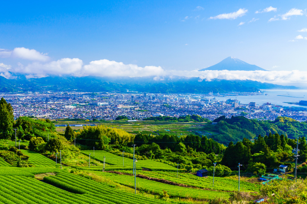
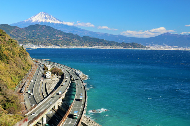
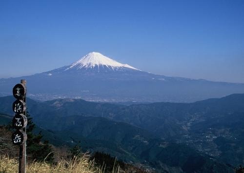
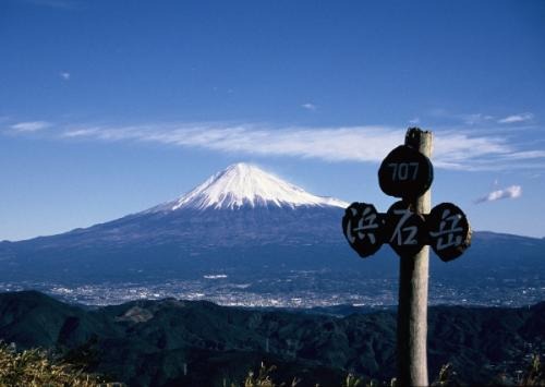
From the summit of Mt. Hamaishi, at an elevation of 707 meters, you can enjoy a 360-degree panoramic view of Shizuoka. Mount Fuji stands before you, while the towns of Yui and Shimizu spread out below. Looking out over Suruga Bay, you can see the Izu Peninsula, and to the north, the mountains of the Southern Alps stretch out.
It is one of the most scenic spots in Yui-juku, a post town along the Tokaido Road.
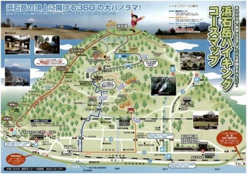
◆◆Hiking Information
● Nishiyama-ji Course: Distance approx. 9 km, approx. 2 hours on foot
Yui Station → Local Products Hall → Hamaishi Outdoor Center → Mt. Hamaishi Summit
● Shiraisawa Course: Distance approx. 9.5 km, approx. 2 hours on foot
Yui Station → Yui Kitada → Shiraisawa → Hamaishi Outdoor Center → Mount Hamaishi Summit
●From Satō Pass to Mount Hamaishi Summit: Distance approx. 10 km, walking time approx. 4 hours
● From the Outdoor Center to the summit of Mt. Hamaishi: Distance approx. 2 km, approx. 25 min on foot
*Parking is available near the Yui River floodplain and the Hamaishi Outdoor Center
Please check the hiking course map for details.
- Mount Hamaishi
- View of Mount Fuji from Mount Hamaishi
- Mount Hamaishi Hiking Trail Map (from the Shizuoka City website)
Basic Information
- Address
- Ogouchi, Shimizu Ward, Shizuoka City, Shizuoka Prefecture 424-0302
- Telephone Number
- 054-221-1071
- Access
[Car]
60 minutes from the Shimizu Interchange on the Tomei Expressway[Public Transportation]
60 minutes by car from Shimizu Station- Website
https://www.city.shizuoka.lg.jp/okushizuoka/spot/s000137.html
*Please note that business hours, holidays, and prices are subject to change, so please check with the contact information provided before visiting.